Ballyboy Castle
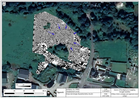
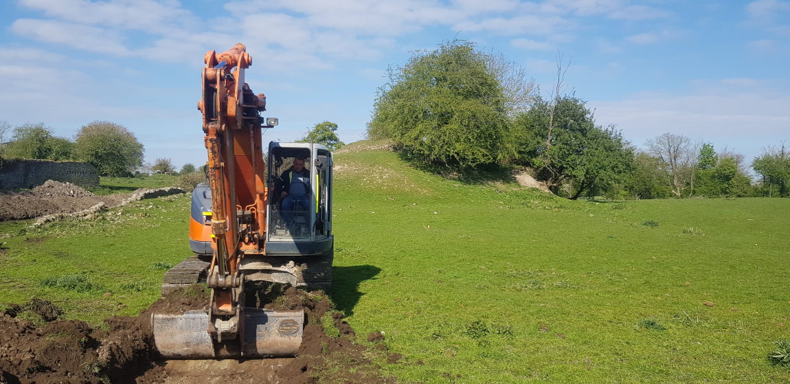
For several years the IHS provided the local community with voluntary heritage advise, culminating with geophysical surveys, archaeological testing and archaeological monitoring from 2022-2024.
Archaeological and Historical Background
Ballyboy is in the Electoral Division of Kilcormac, in Civil Parish of Ballyboy, in the Barony of Ballyboy, in the County of Offaly. The Irish name for Ballyboy is Baile Átha Buí, which means the town (or townland) of the yellow ford. The history of the castle has been well documented in a gazetteer on Offaly Castles, by Caimin O’Brien, with Ballyboy today one of only two castles covered for the county. The below text is taken from this gazetteer:
The remains of a low motte and bailey castle are in a field in Ballyboy village. This earth and timber castle was constructed by the Anglo-Normans close to a fording point over the Silver River c.1180-1200. Ballyboy Castle was initially built as a secure garrison for the Anglo-Norman army as they advanced through this region using the routeways in Fir Cheall.
Once the region of Fir Cheall had been secured by the Anglo-Normans, the castle acted as a focus for settlement which grew up around and under the protection of the earth and timber castle. The townland of Ballyboy, also known as Athboy [Átha Buí / yellow ford], was situated in the Gaelic territory of Fir Cheall, in the kingdom of Mide. This territory formed part of the medieval cantred [Anglo-Norman administrative subdivision of land] of Ardnurcher [Horseleap, Co. Westmeath] in the Anglo-Norman lordship of Meath. After the successful Anglo-Norman military campaign in Ireland, the Kingdom of Mide was granted to Hugh de Lacy, who granted the cantred of Ardnurcher to one of his knights, Meiler fitz Henry. The lands of the cantred of Ardnurcher extended from the motte and bailey castle at Drumcullen, standing on the banks of the Camcor River, to the barony of Moycashel in Co. Westmeath. Towards the end of the 14th century, the O’Molloys took possession of the Anglo-Norman castle of Ballyboy. The lands and castle of Ballyboy remained in the hands of the O’Molloys until the Irish Wars of 1641-53. After this war the lands and castle of Ballyboy were confiscated by the Commonwealth government and granted to Sir William Petty. During the Williamite Wars in Ireland of 1688-91, the village and castle of Ballyboy became a garrison for Williamite soldiers. In 1690, the Jacobite forces attacked and burnt the town and the Williamite forces took refuge in the castle located on the ‘Mount’ in the centre of the village.
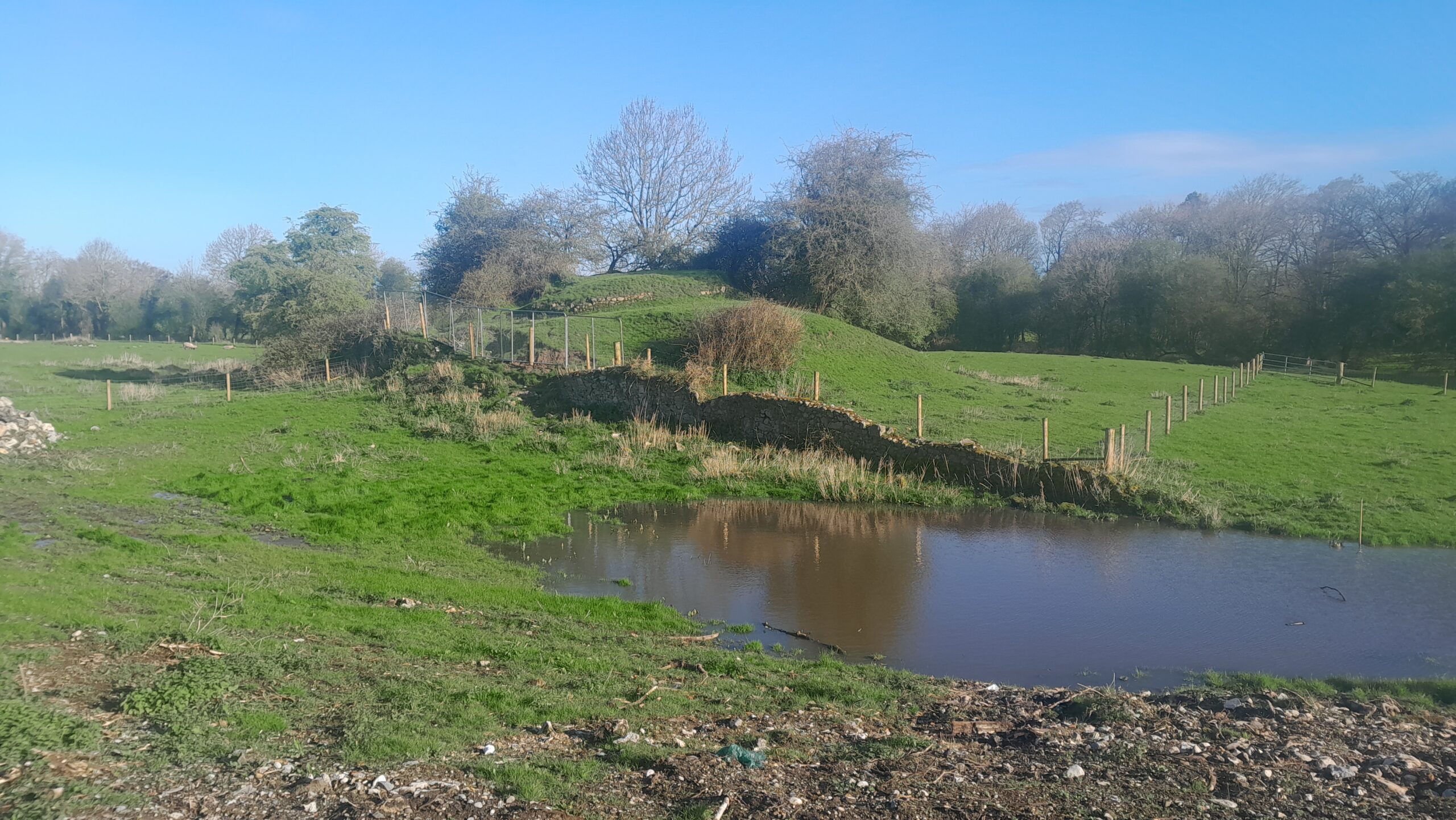
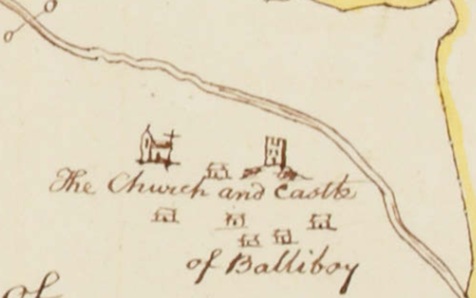
The archaeological remains of the earth and timber castle consist of a large D-shaped bailey that lies to the southwest of the low motte and survives today as a well-defined curving field boundary. The poorly preserved remains of a wall belonging to a stone structure can be seen standing on the summit of the motte. The interpretation and dating of this feature is impossible without archaeological excavation. This wall may belong to the stone castle depicted standing on the summit of the motte on the 1654 Down Survey map.
Alternatively the wall may belong to the post-medieval period, when a limekiln was built into the northern side of the motte. In the post-medieval period, the castle was in ruins and the stone from it was probably reused in the construction of the present houses in the village. During this time, a stone wall was constructed along the base of the motte on the southern side. The church and castle with its associated settlement can be seen depicted on the 1654 Down Survey map of Ballyboy Barony. The Church of Ireland ruins are located on the site of the medieval church (O’Brien 2013, 5).
The castle site (OF031-015001) is described in the Archaeological Survey of Ireland (ASI) as ‘not visible at ground level [but recorded in] the Down Survey as ‘a castle on a mount’ (Loeber 1988, 26-30). The motte-and-bailey (OF031-015002) is recorded in the ASI as:
Located on a slight rise in undulating countryside with river to the N. Small flat topped conical shaped mound (H 3.5m; top diam 12m approx.; base diam 22m) which is badly disturbed on all sides by the insertion of a lime kiln at N and a field wall at S. There is evidence of circular wall made of roughly coursed limestone rubble with mortar on the summit of the motte. This may be associated with the lime kiln which is built into the N face of the motte. There is no clear evidence of a bailey surrounding the motte, however there is a raised area to the N of the motte where once according to local information there stood a castle (JKAS 1946-7, 16). This may be the original bailey area.
This motte was used as a last refuge of defence by Williamate forces in September 1690. The Williamite chronicler, George Story, has left the following account of the attack on Ballyboy by the Jacobites: ‘another Party burnt Balliboy, a village 8 miles from Birr [recte 20 miles or 16.5km], wherein there was then six companies of the Earl of Drogheda’s Regiment, who finding themselves very much outnumbered, and the village no ways tenable, they retired all to a mount nigh the middle of the same village, which they defended till the Irish were obliged to quit the place, have killed us about 28, themselves leaving 16 dead upon the streets, besides several more that were killed in plundering the houses.’ (1693, 46) The mount referred to in the above account clearly is the motte (OF031-015002-).
Findings
The archaeological and historical evidence indicate Ballyboy motte/castle (SMR OF031-015002) was an extremely important site, around which a medieval settlement (SMR OF031-015003) developed. The site continued to act as an important foci of settlement for several centuries after its twelfth century foundation. However, both the geophysical survey (Dowling 2022) and subsequently the programme of archaeological testing indicate significant disturbance to the site in the early modern period, most notably in Trenches 1 to 4. This disturbance includes, but is not limited to, field clearance, burning close to the site (probably related to the destruction of the ‘old hall’ in 1967), general dumping and raising of the ground level of the site. The ground surface has most obviously been raised toward the fields eastern and southeastern extent close to the Ballyboy Road and ruined town hall, where the introduction of modern deposits has raised the ground surface to 2m+ above the ground surface at the base of the motte. No archaeological deposits were recorded during testing, except for a small area of cobbling, possibly dating to the 19th century, in Trench 4.
References
Dowling, G. 2022. Geophysical Survey Report, Ballyboy, Co. Offaly (SMR OF031-015001-3): Licence 22R0109. Unpublished Technical Report for Ballyboy Community Group.
O’Brien, C. 2013. A Gazetteer of Castles in County Offaly: Ballyboy. Offaly County Council. (available on request – contact us)
Shine, D. 2022. Licensed Archaeological Testing Report, Ballyboy, CO. Offaly (SMR OF031-015001-3): Licence 22E0208. Unpublished Technical Report for Ballyboy Community Group.